Platte Creek Campground
Pictures and Information
On our way back home from the Badlands Wilderness Campground, we stopped at Platte Creek Campground. We were familiar with the Snake Creek Campground, and stayed in a cabin there for our anniversary. Being the adventurers that we are, we decided to check out a couple of other campgrounds in the area of the southern Missouri River. There are about five of them.
The first one we stopped to see was
Berynuck Campground which is on the west side of the Missouri River. We couldn't stay there because it was too late to register. So, heading across the Missouri River, we bypassed
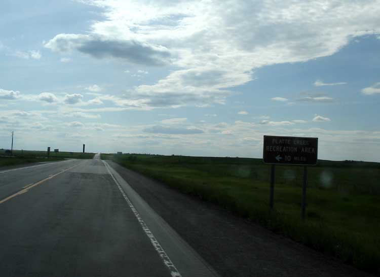
Snake Creek Campground, went about 5 miles east, and took a turn south, not far from a big black tower. The sign said: "
Platte Creek Recreation Area, 10 miles."
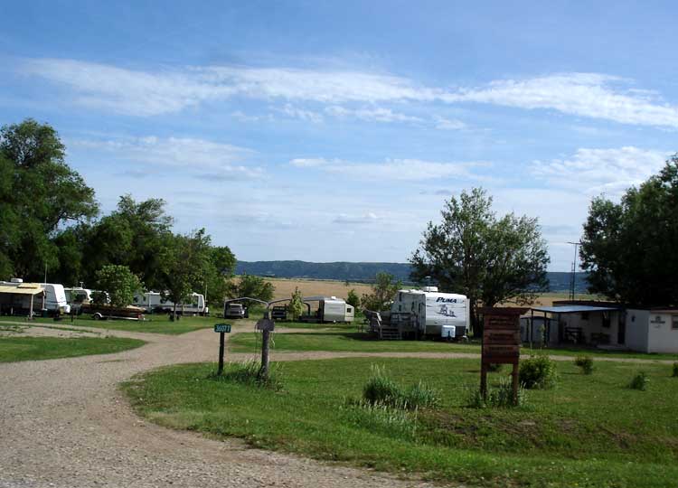
The closer we got to to the campground the more scenic the views became. After 10 miles, we turned right at a stop sign, and passed several RV parks. One is called Riverside Campground, and the other is Johnsonville Campground. The Johnsonville Campground has a little store called the Platte Creek Store. We were glad to see that, in case we were missing something in our camping supplies. (Platte Creek Store Hours Open)

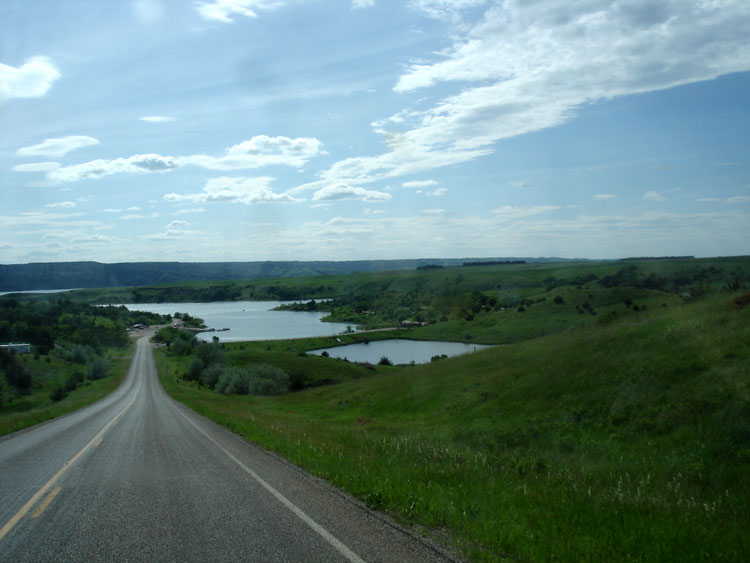
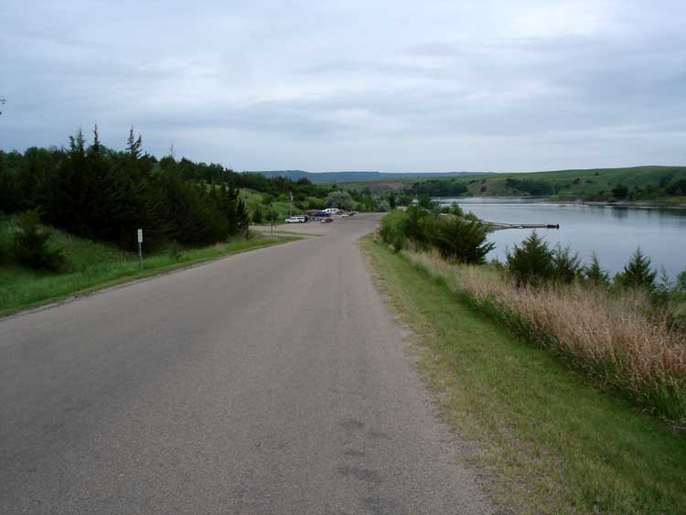
We were delighted with the
view driving down the hill to the campground. Here's a
picture of the ranger station. The ranger was very cordial, and let us drive around and pick a camping spot.

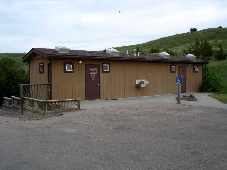
We circled the north campground, passing the
restrooms. The restrooms has
two shower stalls. The
north campground is where the nonelectrical sites are located.
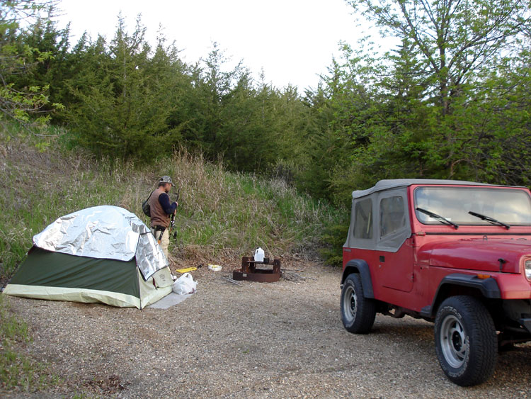
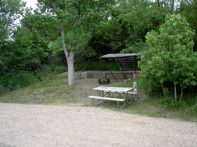
Then we
headed to the south section of the campground, and found it more to our liking. We picked
campsite 45E. (Here's
another pic of 45E) After our first night, we switched to
campsite 48E, which was more level for our tent. So, we had to pay for an electrical site even though we didn't need electricity. The cost per night for an electrical site is $14.00.Site 48E is just a
short walk down to the cove, where we wanted to fish.
There is a shower building there, but it is locked, and when we asked the ranger about it, he said it was "broken." There is also an outhouse.
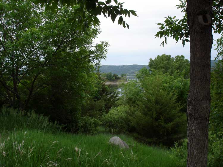
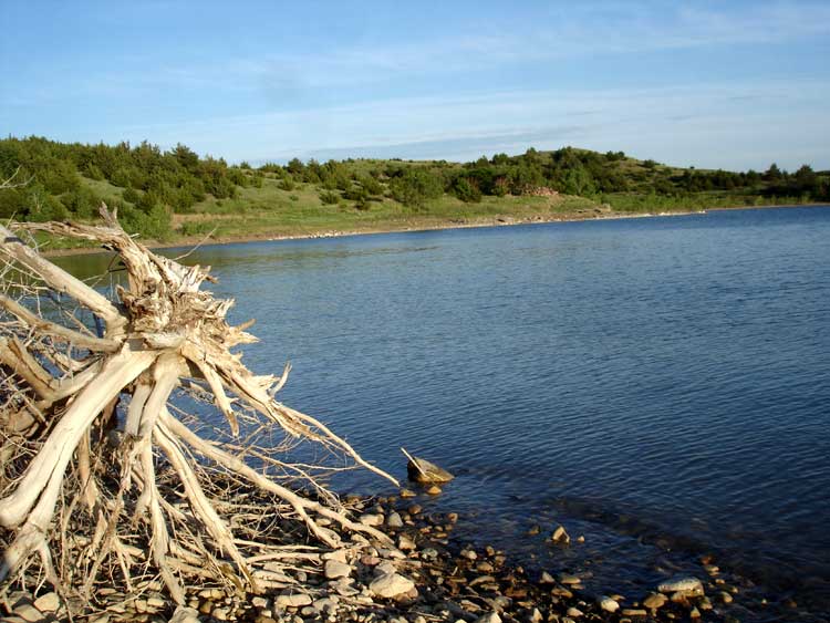
The Scenic Views
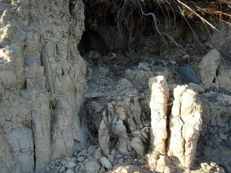
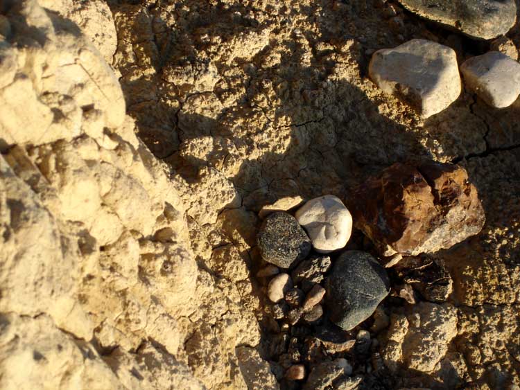
We did some
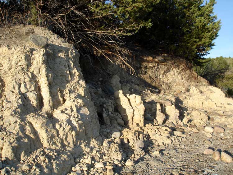
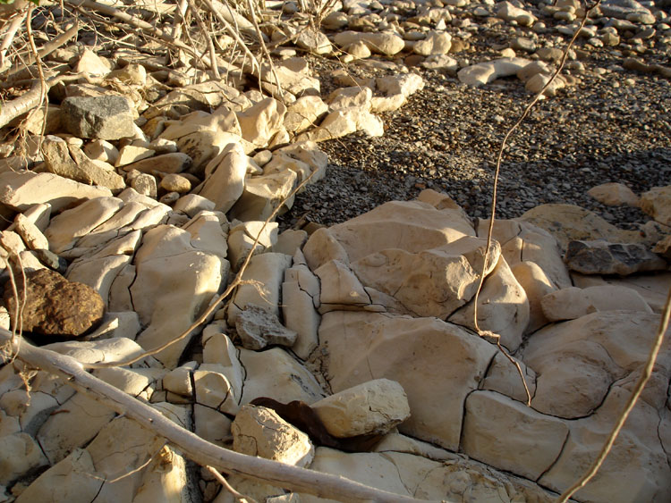
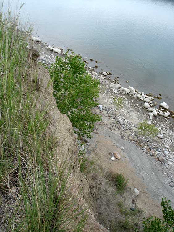
exploring after setting up camp, and as it turns out, 3/4 of the
shoreline in the cove is covered in clay, and if you get your shoes wet, or it rains, the clay sticks to them. What a mess! When you stay dry, you can walk around the
clay formations. It's pretty cool, like in the
Badlands, but on a real small scale. Here's a
closer picture of the clay. The tiny pieces look like pebbles, but don't be fooled, it is clay! All of these supposed
pebbles on the shoreline are really small pieces of clay.
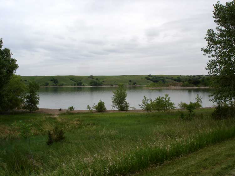
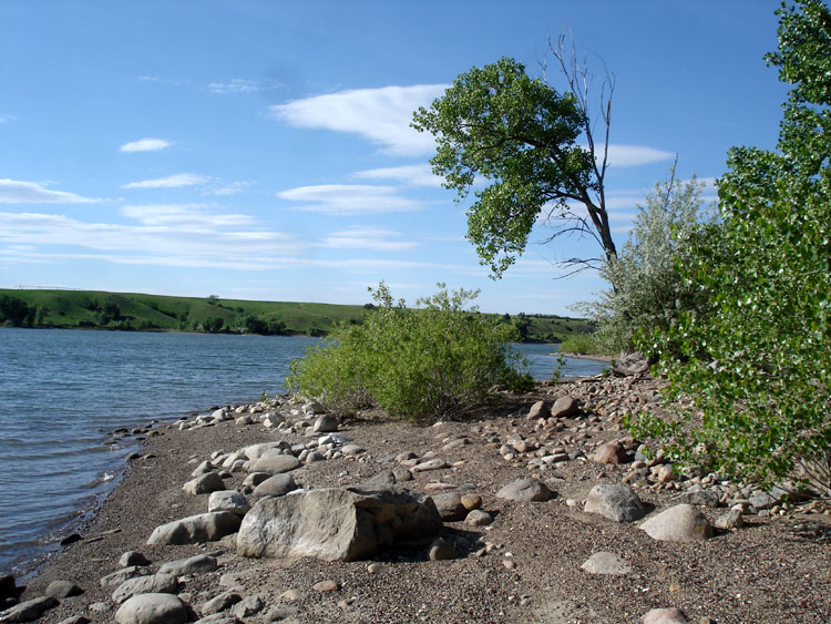
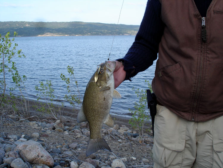
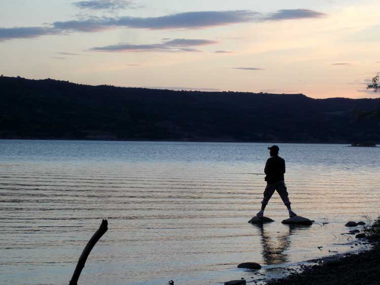
So we had to do our
fishing on the
other side of the hill, where it is mostly
sand and rocks. Here's another picture of the
shoreline looking south. Vlad caught several
bass there using a
Rapella, and we caught several Carp on worms. Here's another fish caught with a Rapella picture.
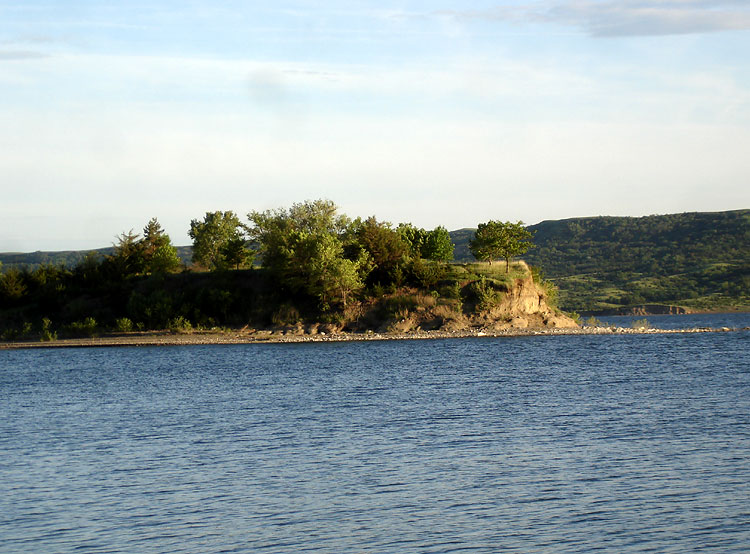
The view from there is rather scenic. Looking
south is a penninsula with a cliff. Looking west, are some hills and a
good sunset view.
Platte Creek also has an
"unofficial" beach area. "Swim at your own Risk."
Campsite 41E overlooks this
beach area.
Campsite 54E is across the street. Here's a
scenic view of the beach's cove.
We had such a good time at Platte Creek Campground, we went back 2 weeks later for 3 days. In fact, we have decided to make this our official camping/fishing spot for 2009.
Platte Creek Campground Video
A short movie of our camping trip in the fall of 2012.
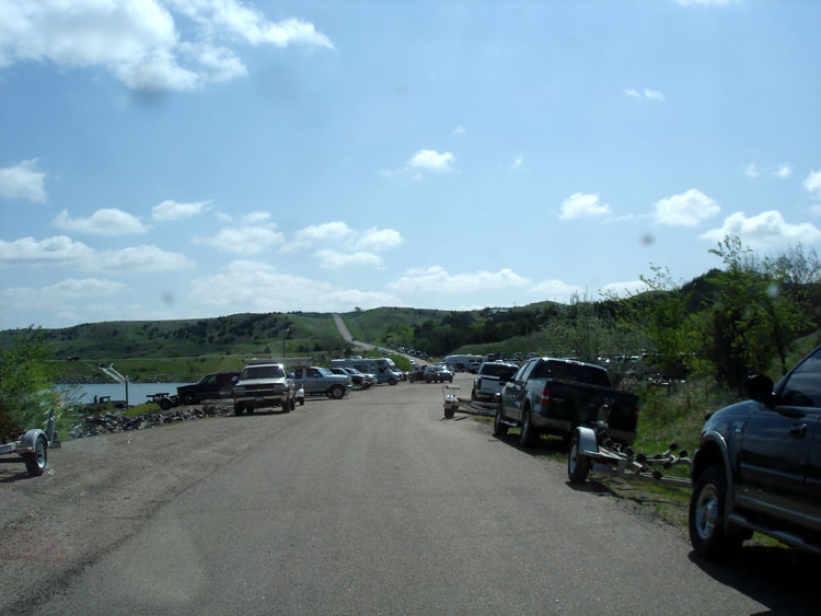
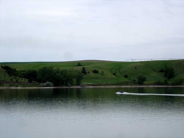
Huge Marina
They have a
huge marina here, and on the weekends the
boat parking lot is
packed. So much so, they had to build a
new parking area. There is
two levels to the new parking area. Also nearby is an
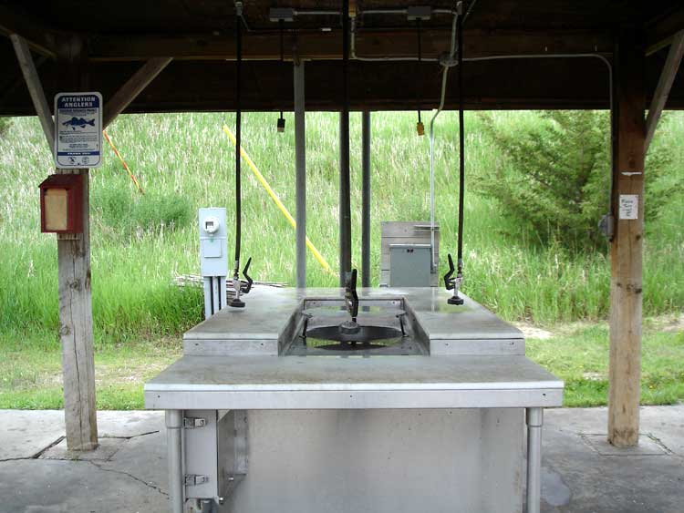
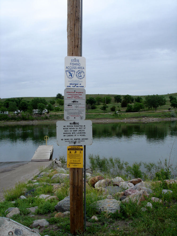
area to clean fish. We looked for
signs about fish limits, but only found one about Walleye. Here's a larger picture of the
Fishing Rules. There was also a sign for "
Tagged fish" in the Missouri River, and what to do if you catch one.
Also they must hold fishing tournaments here, because I saw a sign that said, " Non-Tournament Parking." We can't wait to go back!
More Pictures of Platte Creek Campground
- purple wildflowers along the shoreline
- shoreline erosion
- view of the cove with dead cedar tree trunk
- closer view of the dead cedar tree trunk
- a black, red, and white rock
- a sandy cove looking north
- our fishing spot looking south
- Vlad fishing from the rocks
- a boat flying on the Missouri River
- a view toward the north campground
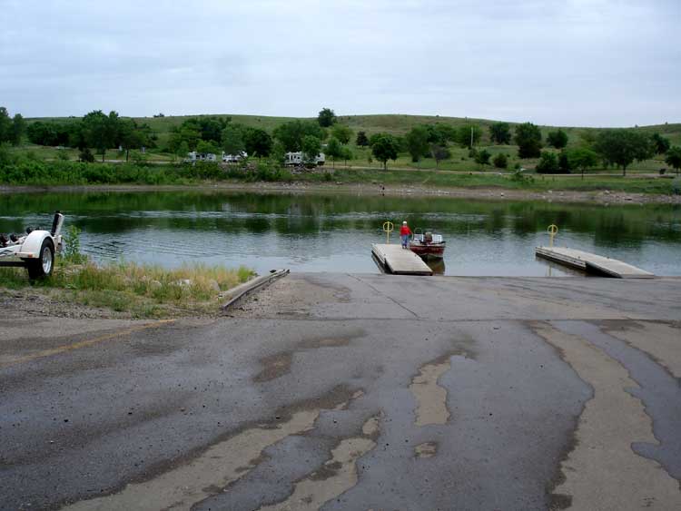
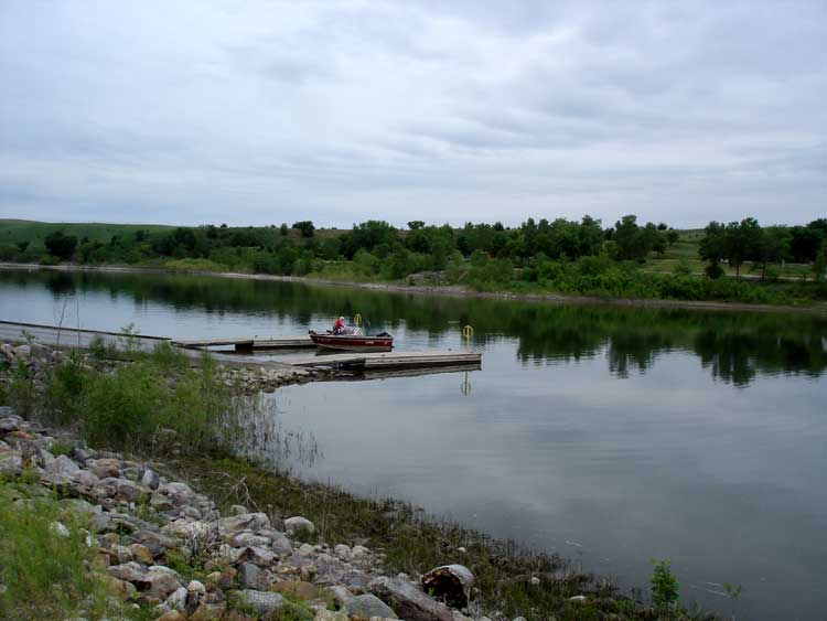
- the boat launch and docks ...
another view of marina...
view toward marina
- the two docks
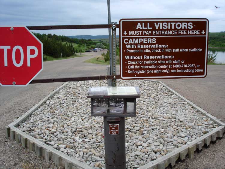
- the self registration box and drop at the entrance...
the ranger station
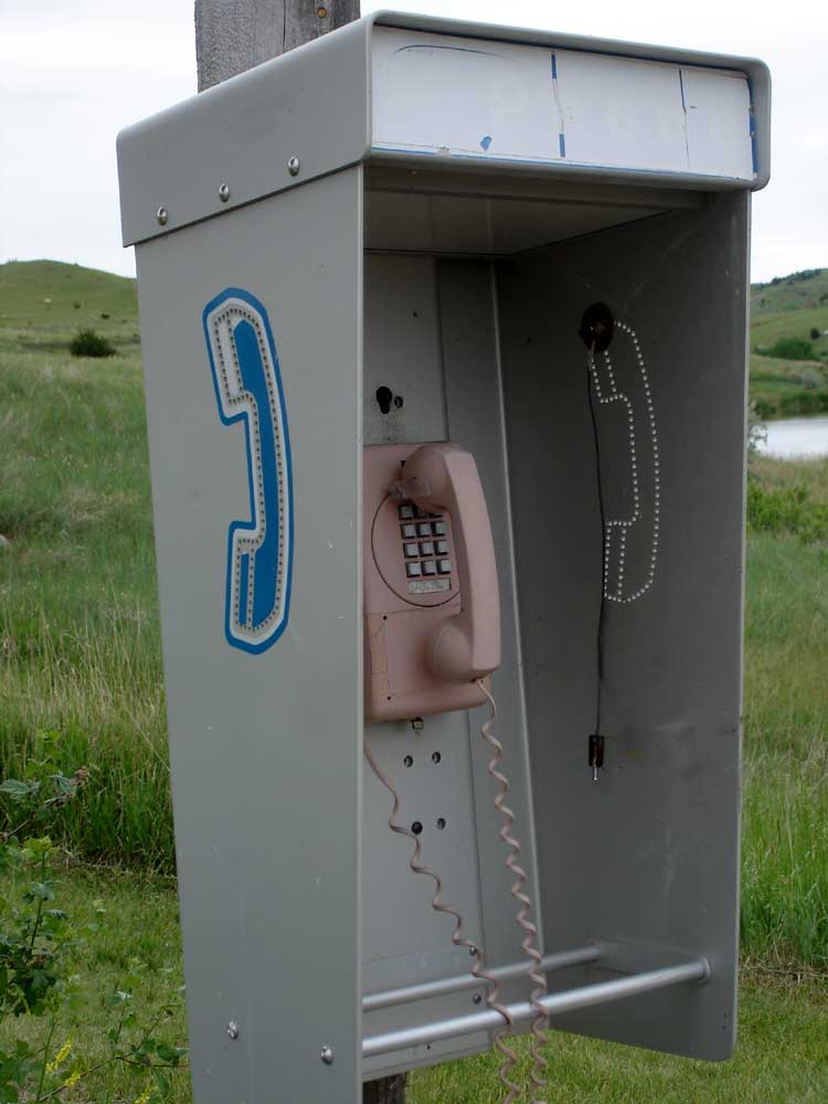
- bulletin board by the restrooms... an old pay phone
- a Platte Creek brochure with phone numbers
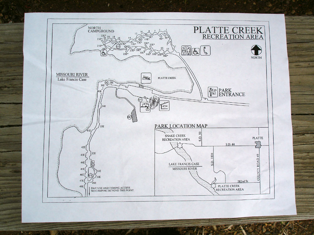
- Platte Creek Campground map
Views of the Cliff
- view of the cliff..
Vlad standing by the cliff...
another view of the cliff...
view from the top of the cliff...
- an old foundation on top of the cliff...
It says J.P.K 73 on the foundation
- looking down from the cliff...
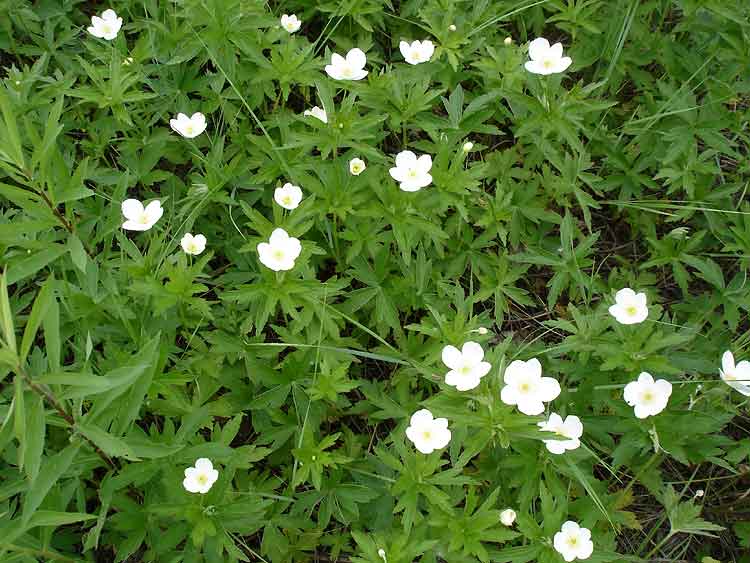
purple wildflowers growing on the cliff
- pinecones on the cliff...
white wildflowers...
fishing below the cliff
More pictures of the clay formations
- clay formation
1... clay formation
2... clay formation
3... clay formation
4... clay formation
5... close up of clay...
closeup of cracked clay...
closeup of clay with my shoes...
clay in the sunset
Emailed Comment: Hi: I was just browsing around and I came across
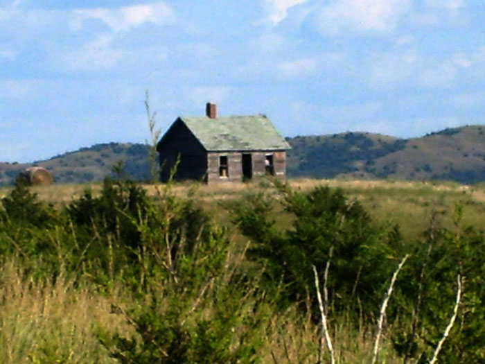
this pic. that you had on here. That old foundation is actually where a picnic shelter used to set they took it down years ago. In case you have not been down there in some time, the high waters of 2011 have eroded that bank and now it's laying next to the river bank. I have a camper down at platte creek in kemnitz campground. If you take a boat ride go south out of the marina and about a mile down there is actually an old house setting up on top a hill. that is an original homestead and the rancher who owns it lives to the east and owns a gravel pit that you can see from the river. In fact I have it on my computer and I am sending it to you to do as you please, feel free to post it. Other than that you got great pics. nice to look at. Doug See picture of the old homestead.
Also: The water has gone way down to normal, But the park has sustained alot of damage. They haven't been open at all this year. I think some people have been camping down there and fishing and have gotten a good deal, not charging and the electricity has been shut off. The restrooms have sustained alot of damage. They are seriously roughing it. That old house is a mile to mile and a half south of the bay and can only be seen by boat. no road goes there unless you drive through that owners property. fortunatly that house sits way back high above a bank to where it won't crumble to the river banks but can still be seen, it's also on the east side of the river. It would be one heck of a hike by shoreline to see it, better plan on a day. anyhow, have a great day as I have to go now. Doug > Date: Mon, 29 Aug 2011